PLATE XLVIII.
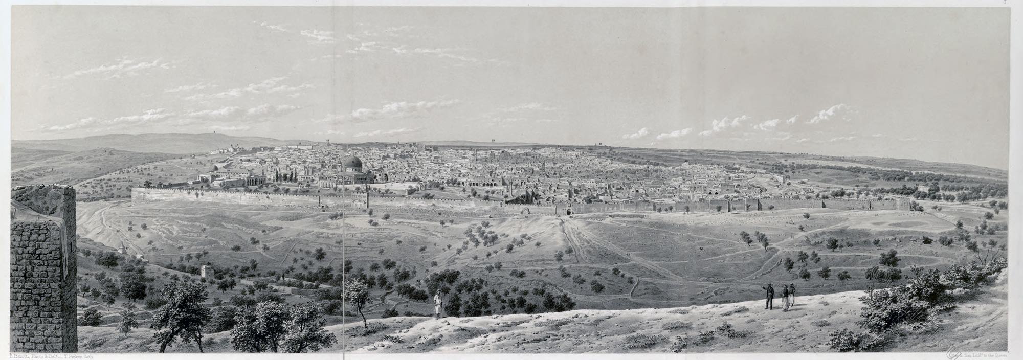
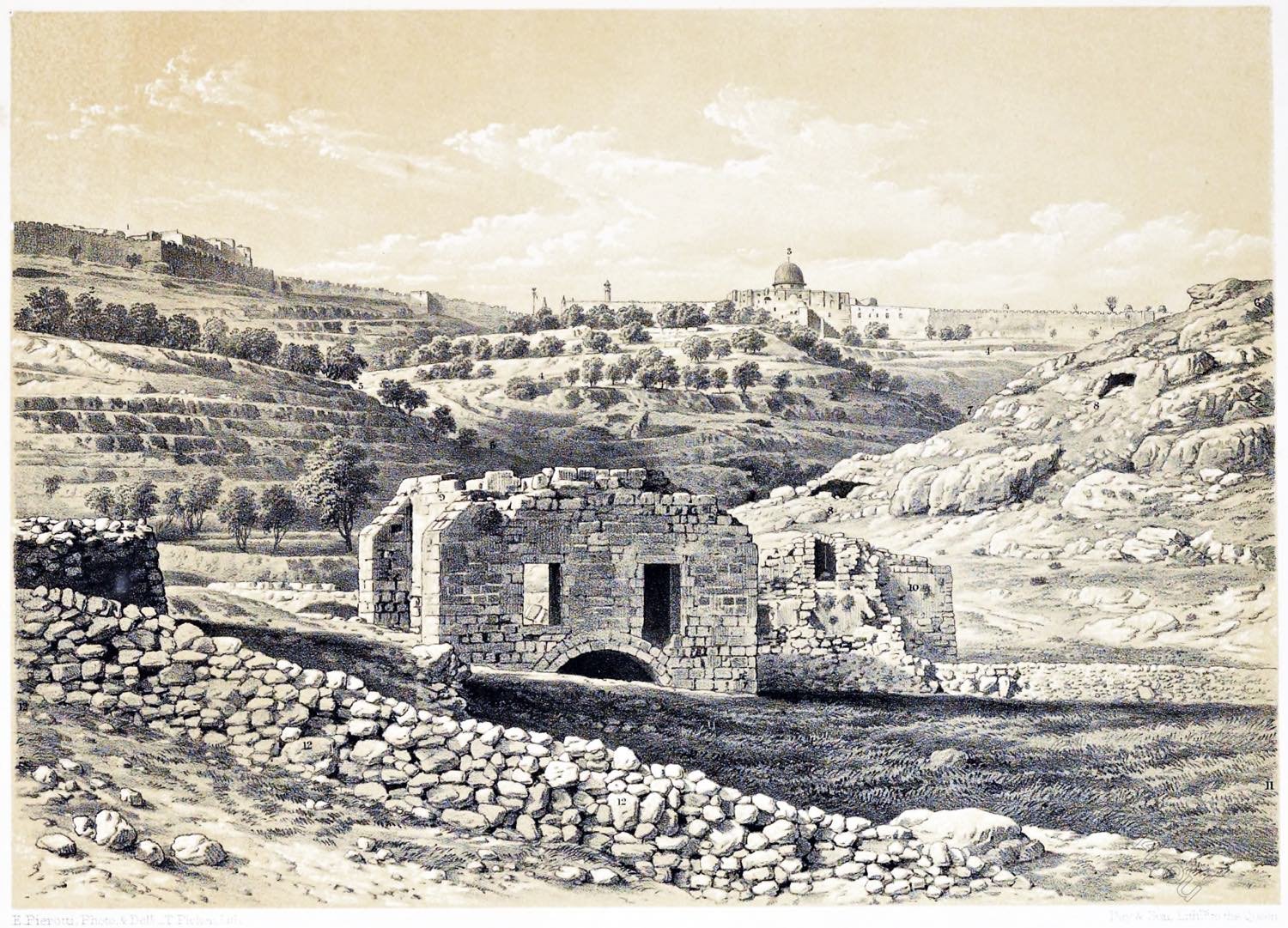
SOUTH-EASTERN EXTREMITY OF THE VALLEY OF SILOAM.
- City of Mount Sion (Zion).
- Mount Sion (Zion). Mount Zion or Zion Hill is the southwest hill of Jerusalem and lies outside the Old City wall. The name refers to Zion, which was originally a tower-castle of the Jebusites, then the city of David, who conquered this castle around 1000 BC, since the time of Solomon the Temple Mount and from then on the whole Temple city of Jerusalem. The Roman destruction of Jerusalem in the Jewish War (70 AD) marked a turning point in the city’s history, and as a result the name Mount Zion migrated to the southern hilltop of the south-west hill, which had not been called that before.
- Mosque el-Aksa. The al-Aqsa Mosque is a mosque on the Temple Mount in Jerusalem’s Old City. It is considered the third most important mosque in Islam after the al-Harām Mosque with the central sanctuary of the Kaaba in Mecca and the Prophet’s Mosque with the tomb of the Islamic prophet Mohammed in Medina. Four minarets belong to the mosque.
- Ophel. From the present southern wall of the Jerusalem Temple Mount, a narrow ridge runs south to the Pool of Siloah. The northern part of this ridge is the Jerusalem Ophel, the southern part the City of David.
- Valley of Hinnom. The gorge is located in the south of the Old City of Jerusalem. It extends from the foot of Mount Zion in an easterly direction to the Kidron Valley. In royal times, child sacrifices were offered to Moloch in Gehinnom as well as in Tofet. The prophet Jeremiah condemned this cult several times and predicted that for this reason Tofet and Gehinnom would be called the “Valley of Murder”. The place of worship in the Hinnom Valley, where the blood of the sacrificed humans and animals was led to the earth, was thus in the imagination of the sacrificers the entrance to an underground realm of the dead. This therefore received its name from the place where its entrance was located.
- Mount of Offence. The most southern portion of the Mount of Olives is that usually known as the “Mount of Offence,” Mons Offensionis.
- Valley of the Kidron. The Kidron Valley is a valley that separates the Temple Mount and the Old City of Jerusalem to the west and the Mount of Olives to the east.The Kidron Valley begins in the north of East Jerusalem in the area of the American Colony and Sheikh Jarrah neighbourhoods. It first runs in an easterly direction, turns south below Mount Scopus and then separates the Old City of Jerusalem from the Mount of Olives. In ancient times, this section of the valley was deeper than today and ran directly along the eastern wall as Jerusalem’s natural moat. The city was therefore easily visible from the Mount of Olives, but it could not be attacked from the east.
- Cave.
- Ancient Arab Building.
- Bir-Eyub. En-Rogel. A well on the border of Judah and Benjamin. It was undoubtedly a well not far from Jerusalem. Some researchers think that it is today’s Bir Eyub, a spring about 800 m south of Jerusalem in the Kidron Valley. Others, however, point to the “Well of the Virgin” at the south-eastern corner of the city, which, however, seems too close to the city to be consistent with the events mentioned above.
- Kidron. The name of a river in the Kidron Valley
- Walls and Ruins.
Source: Jerusalem Explored. Being a description of the ancient and modern city, with numerous illustrations consisting of views, ground plans, and sections by Ermete Pierotti; translated by Thomas George Bonney (Fellow of St Johns College, Cambridge). London: Bell and Daldy; Cambridge: Deighton, Bell and Co. 1864.
Related
Discover more from World4 Costume Culture History
Subscribe to get the latest posts sent to your email.

