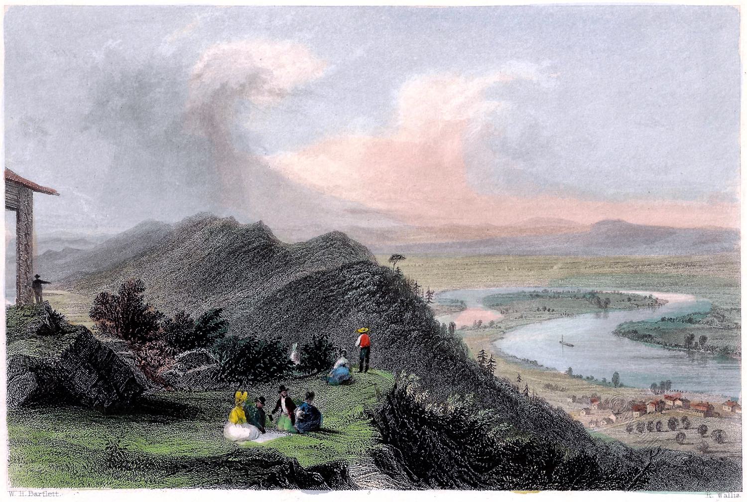
VIEW FROM MOUNT HOLYOKE.
The Oxbow Connecticut River Valley
Probably the richest view in America, in point of cultivation and fertile beauty, is that from Mount Holyoke. The bald face of this mountain, which is turned towards Northampton, is about one thousand one hundred feet above the level of the Connecticut river, (or Quonnecticut, as pronounced by the Indians,) and commands a radius of about sixty miles. The ascent at the side is easy; and it is a fashionable climb for tourists, whose patronage of ginger-beer and sunrises maintains a shanty and a hermit on the top, and keeps in repair a series of scrambling but convenient ladders at the difficult points of the enterprise.
The view immediately below presents a singular phase of the scenery of the river, which seems here to possess a soul for beauty, and loiters, enamored and unwilling to flow on, in the bosom of a meadow which has no parallel in New England for loveliness and fertility. Four times the amorous stream turns to the west, and thrice to the east, threading its silver tide through the tender verdure as capriciously as a vein in the neck of beauty, and cheating twelve miles of direct course into twenty-four of coil and current.
The meadow is almost entirely unfenced, and the river is fringed in all its windings with weeping elms, wild flowers and shrubs, while up toward the town the fields rise in slightly swelling terraces—forming a foreground to one of the most sunny and cheerful villages in Massachusetts.

The more extended view embraces a great variety of mountain range — Monadhoe in the north-east, Saddle Mountain in the north-west, Mount Tom (between which and Mount Holyoke the Connecticut seems to have broken with the outlet waters of an immense lake) close on the south-west, and spurs of the Green Mountains advancing and receding in the course of the Connecticut in the north. Geologists speculate extensively on the lakes that once existed in the bosoms formed by these mountains—but we have not time to go back to the deluge.
There is a small hamlet at the foot of Mount Holyoke, on the eastern side of the river, called by the Indian name Hoccanum, and another at the foot of Mount Tom, on the western side, called Pascommuc, both of which were burnt by the savages in the early settlement of the country, and the inhabitants killed or taken captive. The early history of all these towns on the Connecticut river is filled with events of Indian warfare.
Northampton, by its rich alluvial land allured the first settlers of Massachusetts long before most of the country between it and the sea-coast possessed an inhabitant. These adventurous pilgrims seated themselves in the midst of an unprotected wilderness, and surrounded by populous Indian tribes and, first purchasing the land at the Indians’ valuation, they defended; themselves afterwards as they might from the aggressions of these and others.
The township of Northampton (called Nonotuc by the aborigines) was first bought in 1653. It was conveyed to John Pyncheon for the planters by Wawdillowa, Nenessahalant, Nassicochee, and four others (one of whom was a married woman), who were styled the “chief and proper owners.” The price was “one hundred fathom of wampum by tale, and ten coats,” to which was added an agreement to plough for the Indians, in the ensuing summer, sixteen acres of land on the east side of Quonnecticut River.
These “all bargained for themselves, or the other owners by their consent.” All the aborigines of this country, observes a correct writer on this subject, are owners of the lands on which they dwell—men and women alike. This property in lands, held by the Indian women, is a singidar fact in the history of the savage nations.
Three years after, a rich interval near Northampton, called Capawanke, and containing eight or nine hundred acres, was sold to these same planters by an Indian, named Lampancho, for fifty shillings, at two payments, ” to his entire satisfaction.”
These two purchases give a very fair idea of the Indian purchases made by our forefathers. In the former, ninety square miles were sold for a hundred fathom of wampum and ten coats! Within this tract were near five thousand acres of interval land, worth at the present time perhaps eight or nine hundred thousand dollars. Unjust as the transaction seems, however, the price was ample to the Indian, who could not have got so much by keeping it, and for whom there was no other purchaser.
The settlers of Nonotuc lived in comparative harmony with the tribe about them; but in the subsequent Indian wars they lived in perpetual fear and agitation. The town was surrounded with palisadoes, “the meeting-house” was fortified, as were most of the private houses, and several forts were built within the town. Still their dwellings were often burnt, their women and children carried into captivity, and their time was divided between war and agriculture.
Source: American Scenery; or, Land, Lake, and River Illustrations of Transatlantic Nature. From Drawings by W. H. Bartlett. Engraved by R. Wallis, J. Cousen, Willmore, Brandard, Adlard, Richardson, &c. The Literary Department By N. P. Willis, Esq. London: George Virtue 26, Ivy Lane. 1840.
Continuing

Discover more from World4 Costume Culture History
Subscribe to get the latest posts sent to your email.

